Eastern Ukraine
Kharkov Region
![]()
 Most of the region is located in the Dnipro Lowland near the Dnipro River. In the north and northeast it abuts the ridges of the Central-Russian Upland, and in the southeast, the ridges of the Donets mountain range. The climate is temperate-continental. Population: 3,184,000.
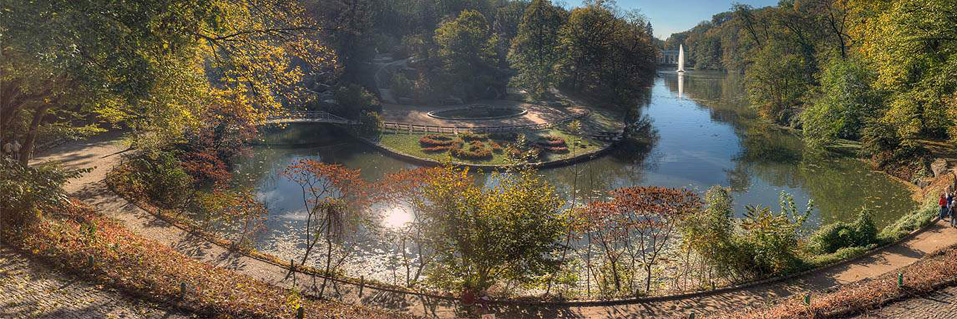
 Kharkov - Kharkov is the largest scientific industrial and trade center of Ukraine. At the same time all guests and visitors who come to city on business trips say that they like it here. They admit that the city has beautiful parks, squares and gardens and that it has a lot of greenery.City's main square is the largest square in Ukraine and one of the largest in Europe. This is the venue of festivals, concerts, fairs, rallies, meetings, and other public events.
To learn more about sights, excursions and tours in this region click here
Luhansk Region (Ukr. Luhansk Oblast')

The Lugansk region appeared on the map of Ukraine as admin istrative economic territorial unit in June 1938 as a result of division of Donetsk region into two regions: Stalin (Donetsk region to-day) and Voroshilovgrad (Lugansk region to-day). The region is located in the south-western part of Ukraine in the basin of the middle Seversky Donets river. The river Seversky Donets, the tributary of the great Russian river Don, divides the territory of the region into two parts - the northern and the southern one. The northern part of the region is mainly agricultural and the southern one is famous for its industrial centres. The region lays in the forest-steppes and most of the terrain is hilly and interwoven with deep ravines. 60 lakes and small tributaries to the main river Seversky Donets are very picturesque. Climate is moderate continental with rather short and cold winters that have little snow and hot summer.
The area of the region is 26,700 square km. The number of population is 2.5 mln. It belongs to the regions with high population density.

The history of the region is alike the history of its neighbouring Donetsk region. The first settlements appeared here during the late Palaeolithic Age (40-12 thousand years ago). During the Copper and Bronze Ages the land was settled by cattle-breeding and agricultural tribes. Archaeological excavations testify to the fact that at that time the copper ore was here in the VIII-VII cc. B.C. They were pursuited by the Scythians and later by the Sarmatians (VII-III cc. B.C.).
During the Kievan Rus time (IX-XIII cc.) this land belonged to Pereiaslav Principality, and it was often raided by the nomadic tribes of Pechenegs and Polovtsy. Numerous stone figures that are attributed to these tribes can be found all over the region. Presumably it was in this area that the battle of 1185 between the army of Novgorod-Seversky Prince Igor and the Polovtsy was fought, and this battle was masterfully described in the “The Tale of Igor’s Host” that became a gem of Slavic literature.
The Tartar-Mongolian invasion in the XIII c. resulted in the desolation of this land. Since that time for almost three centuries this area became “The Wild Field” that separated Moscow Russian Principality from the Crimean tartar Kaghanate. Being at a big distance from the central provinces of Russia and Ukraine and not under any subjection, it attracted the fugitives from Russia and Ukraine who later were joined by Zaporozhian Cossacks. In the XV-XVI cc. the run-away peasants built here their settlements that were often devastated by the Tartars. In 1640-ies the Don Cossacks built some well protected outposts in the North of the region. Very intensively it was populated at the end of the XVII c. when peasants and Cossacks fled here from the Right-bank Ukraine that was left under the Polish rule. The population of Lugansk supported Stepan Razin’s rebellion in 1670-1671 and Bulavin’s rebellion in 1707-1708. Both uprisings, that inflamed all Donbas lands, were cruelly crushed by the Tsarist military forces.
Following the suggestion of Catherine II, the Government decided to construct a number of fortified settlements to protect the Empire from the Tartars. Serbs, Croats and Montenegrins were invited to help in the construction of numerous fortresses. The people from the Balkan countries who ran away from the Turks created here in 1753 a new territory that was called “Slav-Serbia”. Orthodox Christians from the Austrian Empire also received this invitation. That is how among the new settlers appeared Hungarians, Poles and Germans. But the bulk of the population made the Cossacks from Russia and Ukraine. After the Russian-Turkish wars in 1768-1774 and in 1787-1791, when Russia got an access to the Azov and Black Seas, the necessity of this fortifications passed and at the end of the XVIII c. the southern areas of the region were turned into metallurgic centre. In the early XVIII c. coal reserves were discovered in Lugansk region and already in the second half of the XVIII c. the region became an important industrial centre. In 1795 the cast iron plant was constructed in Lugansk and revival of the mining industry started. The abolition of serfdom in 1861 accelerated the industrial development. New settlements, factories and railroads were built. The industrial boom caused a considerable re-settlement of peasants from different Russian and Ukrainian regions.
The natural reserves of Lugansk Region are rich. Its supplies of high-quality anthracites and coke coal are calculated by billion tons. Exactly the history of the whole Donbas coal basin began from here: at the beginning of the XVII century the first coal deposits were opened in present day Lugansk region. Soon in the basin of the rivers of Bila and Luhan the landowners and peasants obtained fuel for themselves by the open method. In 1795 in the vicinity of to-day’s town of Lisichansk the industrial development of coal for the Lugansk Iron Foundry began for the first time in Donbas. At the end of the XIX c. almost all enterprises – mines, metallurgic, machine building plants - belonged to the foreigners – English, French, Belgian, and German. After the Revolution of 1917 all these enterprises were nationalized.
The region got its name after its main city: since 1938 it was named “Voroshilovgrad” after political leader and Marshal of the Soviet Union Klim Voroshilov who worked as a steel-worker here and later organized the first Red Army units in Lugansk. In 1958-1970, when Voroshilov fell into political disfavour, the region returned its old name of “Lugansk”. In 1970-1990 again it was renamed as Voroshilovgrad and since 1990 – Lugansk region.
Today Lugansk Region enters the top five highly developed industrial-economic regions of Ukraine. 5.4% of general fixed assets of Ukraine are concentrated here. Its industrial achievements are explained by three main reasons: Lugansk region has very close relations with three Russian regions - Belgorod, Voronezh and Rostov; it also borders on highly developed Donetsk and Kharkov regions; the geographical position of the region is very favourable - it occupies a well-developed agricultural territory and it has neighbours with advanced economy. Today the region develops the economic potential in close collaboration with many regions of CIS and foreign countries. The trade-economic and humanitarian relations with more than 90 countries of the world are supported.
The main wealth of Lugansk region is coke coal. The region has another home energy source – the natural gas and its extraction has been recently started. One fifth part of general volume of industrial products belongs to the oil refining industry. Of great importance are the enterprises of chemical and petrochemical industry, ferrous metallurgy, machine building and metal working.
The long vegetative period, rich black soil and arable lands in the northern part of the region create favourable conditions for a well developed agricultural complex. Lugansk region specializes in cereals (mostly winter wheat and maize) and oil bearing (sunflower) crops.
Intensive development of heavy industry, the density of enterprises and extensive tilling of the land unfortunately have negatively resulted in keeping the nature intact. That is why big attention has been paid to the ecological problems of the region.
To-day Lugansk region has some very interesting steppe reserves and the best in Ukraine horse-breeding centres. The biggest nature reserve is Streletskaia steppe in the utmost eastern point of the Ukraine (village Melovoie, 47 km North-East from Belovodsk). Its 500 hectares plateau territory, interwoven with ravines, present the steppe and flood-land flora, some plants have survived since prehistoric times and are unique. Different animals inhabit this reserve and all of them are under special protection. The reserve has the biggest population of the steppe-marmots. Famous horse-breeding plant that was organized on the initiative of Empress Catherine II (second half of the XVIII c.) is also situated here.
The capital of the region, the city of Lugansk, is a history of the whole region in miniature. Those who are interested more in the history of the industrial development of this region will definitely find useful a visit to Lisichansk. For the lovers of the history of WWII a visit to Krasnodon will unveil one of the most tragic pages of this war. In Starobielsk one can learn about the history of the Poles’ deportation on the eve of WWII. And everybody will enjoy a tour to one of the nature reserves and especially to a horse-breeding plant in Belovodsk.
To learn more about places for sightseeing in Lugansk Region clich here
Donetsk Region

 Donetsk region is often by mistake associated with a big area known under the name of “Donbas” - the lands of the Eastern part of Ukraine and part of Russia up to the Don river, extremely rich in different mineral resources. The region appeared on the map of Ukraine in 1938 as a result of division of the original Donetsk Region (established in 1932) into two regions: Stalin (to-day Donetsk) and Voroshilovgrad (to-day Lugansk). That is why it is difficult to put a distinctive and sharp border line between these two most powerful industrial regions both in their history and in economic development.
Donetsk region is situated in the steppe zone of the south-eastern part of Ukraine and reaches the Sea of Azov shores in the South. Climate is temperate continental with rather hot summer with draughts. One of the problems of the region is water shortage. The area is 26,500 square km, or 4.4% of the total territory of Ukraine. By number of the population (4.7 mln that constitutes 10% of overall country population) Donetsk region is the biggest one and most densely populated region in Ukraine.

It is difficult to name all mineral resources of this area but without mentioning some basic ones it would be impossible to understand why this region plays such an important role in economy and political life of the country. The Donetsk basin contains huge reserves of high-quality coal, its production has been carried since 1795 and it is the basic source of coal supply in Ukraine. Donbas coal is especially valuable: over a third of this basin has coking coal and the rest have high grades of coal. The coal has also a high ash content, as well as sulphur, which in a certain measure affects its consumer quality. This coal is valuable for the export perspective. Another important export item of Ukraine is table salt. The largest deposits of very high quality and chemically pure rock salt are concentrated in Donetsk region. It gives the largest output of table salt in Europe. Iron ore and chalk deposits are also rich. Promising future development has gas and oil deposits on the continental shelves of the Sea of Azov. There are also gold deposits in the region but they have not been properly explored.
Only a short list of the main industrial products of Donetsk region: cast-iron, steel, ferrous metals, coke, steel pipes, mineral fertilizers, items of chemical and petrochemical industry, diverse heavy machine engineering, based on the demands of the coal extraction. More than 57% of industrial products made in the region, is exported. The Russian Federation, covering over 22% of the general foreign trade turnover volume, is the main partner of Donetsk Region in foreign economic activity. Having powerful industrial potential, Donetsk region provides almost one quarter of the national industrial production and takes the leading places in Ukraine on making basic types of industrial and agricultural products
History of Donetsk region has been greatly influenced by its geographical location. These lands were first settled in the early Palaeolithic era (300-140 thousand years ago). In the VII c. B.C. this area was inhabited by the Scythian tribes that were followed by the Sarmatians in the II c. B.C. Then came the Huns in the IV c, in the VI - VII cc. the Avars and the Bulgars (proto-Bulgarians). For a long period this vast steppes were invaded by the cattle-breeding tribes of Pechenegs (end of the IX c.), then at the beginning of the XI c. the Turkic tribes came, in the mid-XI c. they were pushed out by the Polovtsy who left numerous stone figures in the steppes. In 1223 the Princes of Kiev fought the Tartars at the river Kalka (now Kalchuk river). After the Tartar-Mongolian invasions in the XIII c. and the formation of the Golden Horde for many years this territory was not inhabited. In the XVI-XVII cc. the southern lands of the region were controlled by the Crimean Tartar Khans who gradually fell under the Turkish rule; the eastern lands little by little were inhabited by the Slavic people who were pushing the tartars out of “The Wild Field”. Soon these lands were ruled by the Zaporozhian Cossacks. The northern territories of the region formed part of Slobodskaya Ukraine (“Slobodian” or “Slobozhanschyna” in Ukr.).
The Russian officials started to build here small military forts closer and closer to the South. With the establishment of the defense line against the Turks in 1731, the Donetsk lands began to be settled by foreign colonies, especially by the German ones. After the Russian-Turkish War of 1768-1774 this land quickly enlarged its population by inviting here people of different status and nationalities. At the very end of the XVIII c. an extensive coal-mining started here and this gave a new impact to the development of this region. In 1861 the serfdom was abolished and new economic era started. The development of the coal mines, metallurgical plants and railroads brought an influx of new businessmen and workers from all over Russia to the Donetsk region. It is one of the explanations why this part of Ukraine had always very close relations with Russia and rather strong pro-Russian sympathies.
At the end of the XIX c.-beginning of the XX c. the leading positions in the economic life of the South of Russia were occupied by numerous foreign companies. Many coal mines and metallurgic plants belonged to British, French, Belgian and German concessions. And it was inevitable that Donetsk region at the beginning of the XX c. had very strong and organized working class that supported the Bolsheviks’ ideas during the Revolution of 1917. Soviet government paid big attention to the development of this industrial region and in the 1930-ies it was turned into the vanguard of Soviet economy. The war of 1941-1945 destroyed to the grounds everything that had been achieved within the past two centuries. It took more than five years to restore the economy and life here.
The capital of the region city of Donetsk is unique in its way - the city was born anew after the devastating years of WWII. Its history is eventful and full of contrasts which are typical for any big industrial centre. But Donetsk in no way looks gloomy, to-day it is one of the most vibrant and prosperous city of Ukraine. Of its own interest is the sea-port Mariupol that combines a well developed industry with the resort attractions. While visiting Donetsk try to find a free day to cover some 160 km to visit one of the most beautiful Sviatogorsk Assumption (Dormition) Monastery. On the way to the Monastery one can make a short stop in the resort town Slaviansk. For those who are interested in more detailed history of the industrial development of the region it is worth to visit such towns as Kramatorsk, Artyomovsk, Makeevka, and Gorlovka.


